
File:Oldest Arctic Sea Ice is Disappearing.png

本预览的尺寸:533 × 600像素。 其他分辨率:213 × 240像素 | 427 × 480像素 | 683 × 768像素 | 910 × 1,024像素 | 1,820 × 2,048像素 | 3,000 × 3,375像素。
原始文件 (3,000 × 3,375像素,文件大小:6.94 MB,MIME类型:image/png)
摘要
| 描述 |
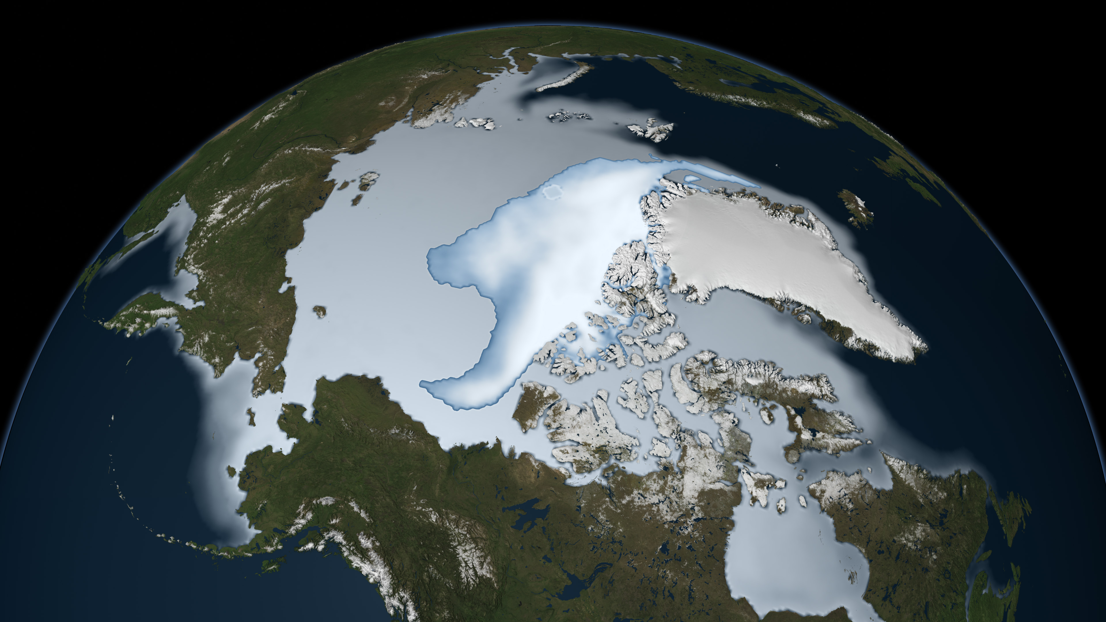
English: The image shows sea ice coverage in 1980 (bottom) and 2012 (top), as observed by passive microwave sensors on NASA’s Nimbus 7 satellite and by the Special Sensor Microwave Imager/Sounder (SSMIS) from the Defense Meteorological Satellite Program (DMSP). Multi-year ice is shown in bright white, while average sea ice cover is shown in light blue to milky white. The data shows the ice cover for the period of November 1 through January 31 in their respective years. |
| 日期 | |
| 来源 |
http://earthobservatory.nasa.gov/IOTD/view.php?id=77270 en:NASA Earth Observatory http://eoimages.gsfc.nasa.gov/images/imagerecords/77000/77270/seaiceage_ssm_2012_lrg.jpg http://eoimages.gsfc.nasa.gov/images/imagerecords/77000/77270/seaiceage_ssm_1980_lrg.jpg |
| 作者 | NASA scientist Joey Comiso |
许可协议
| 本文件完全由NASA创作,在美国属于公有领域。根据NASA的版权方针,NASA的材料除非另有声明否则不受版权保护。(参见Template:PD-USGov/zh、NASA版权方针页面或JPL图片使用方针。) | ||
 |
警告:
|
文件历史
点击某个日期/时间查看对应时刻的文件。
| 日期/时间 | 缩略图 | 大小 | 用户 | 备注 | |
|---|---|---|---|---|---|
| 当前 | 2012年3月2日 (五) 06:18 | | 3,000 × 3,375(6.94 MB) | Sagredo | reduced size to reduce number of pixels |
| 2012年3月2日 (五) 06:14 |  | 3,840 × 4,320(10.03 MB) | Sagredo |
文件用途
以下页面使用本文件:
全域文件用途
以下其他wiki使用此文件:
- cs.wikipedia.org上的用途
- de.wikipedia.org上的用途
- en.wikipedia.org上的用途
- en.wikiversity.org上的用途
- id.wikipedia.org上的用途
- no.wikipedia.org上的用途