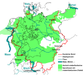
File:Maas memel etsch belt.svg

此SVG文件的PNG预览的大小:650 × 600像素。 其他分辨率:260 × 240像素 | 520 × 480像素 | 832 × 768像素 | 1,109 × 1,024像素 | 2,219 × 2,048像素 | 1,300 × 1,200像素。
原始文件 (SVG文件,尺寸为1,300 × 1,200像素,文件大小:608 KB)
文件历史
点击某个日期/时间查看对应时刻的文件。
| 日期/时间 | 缩略图 | 大小 | 用户 | 备注 | |
|---|---|---|---|---|---|
| 当前 | 2023年8月11日 (五) 02:33 |  | 1,300 × 1,200(608 KB) | Amlz | Reverted to version as of 13:07, 30 May 2017 (UTC) to correct weird vector artifacts |
| 2017年7月22日 (六) 01:00 |  | 1,301 × 1,201(652 KB) | AKAKIOS | Removed the Dutch speaking area and left only the Dutch/Low Frankish dialects in modern Germany. To add the Netherlands and Flanders to this map is inaccurate, both in its contemporary and historical context. | |
| 2017年5月30日 (二) 13:07 |  | 1,300 × 1,200(608 KB) | Mueck | Reverted to version as of 19:16, 27 January 2011 (UTC) Indeed: Correctomundo~commonswiki produced bad quality, autotraced (or some other bad technic ...) and content: the "historic continuum" is just the interesting thing in this map ... | |
| 2014年8月12日 (二) 00:03 |  | 1,301 × 1,201(652 KB) | Correctomundo~commonswiki | Fixed. | |
| 2014年8月11日 (一) 23:55 |  | 1,300 × 1,200(608 KB) | Correctomundo~commonswiki | Same problem. | |
| 2014年8月11日 (一) 23:55 |  | 1,300 × 1,200(608 KB) | Correctomundo~commonswiki | Same problem. | |
| 2014年8月11日 (一) 23:54 |  | 1,625 × 1,500(241 KB) | Correctomundo~commonswiki | Color correction. | |
| 2014年8月11日 (一) 23:53 |  | 1,300 × 1,200(608 KB) | Correctomundo~commonswiki | something went wrong with the colours | |
| 2014年8月11日 (一) 23:53 |  | 1,625 × 1,500(57 KB) | Correctomundo~commonswiki | Removed Dutch and Standard Dutch influenced dialects. These are not German dialects, even though there historically was a continuum. | |
| 2011年1月27日 (四) 19:16 |  | 1,300 × 1,200(608 KB) | NordNordWest | c |
文件用途
以下页面使用本文件:
全域文件用途
以下其他wiki使用此文件:
- az.wikipedia.org上的用途
- cs.wikipedia.org上的用途
- de.wikipedia.org上的用途
- en.wikipedia.org上的用途
- fi.wikipedia.org上的用途
- fr.wikipedia.org上的用途
- ka.wikipedia.org上的用途
- ko.wikipedia.org上的用途
- sr.wikipedia.org上的用途
- zh-yue.wikipedia.org上的用途


