
File:PIA04256 Map of Martian Silicon at Mid-Latitudes.jpg

預覽大小:800 × 360 像素。 其他解析度:320 × 144 像素 | 640 × 288 像素 | 1,024 × 461 像素 | 2,065 × 929 像素。
原始檔案 (2,065 × 929 像素,檔案大小:170 KB,MIME 類型:image/jpeg)
摘要
| 描述 |
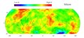
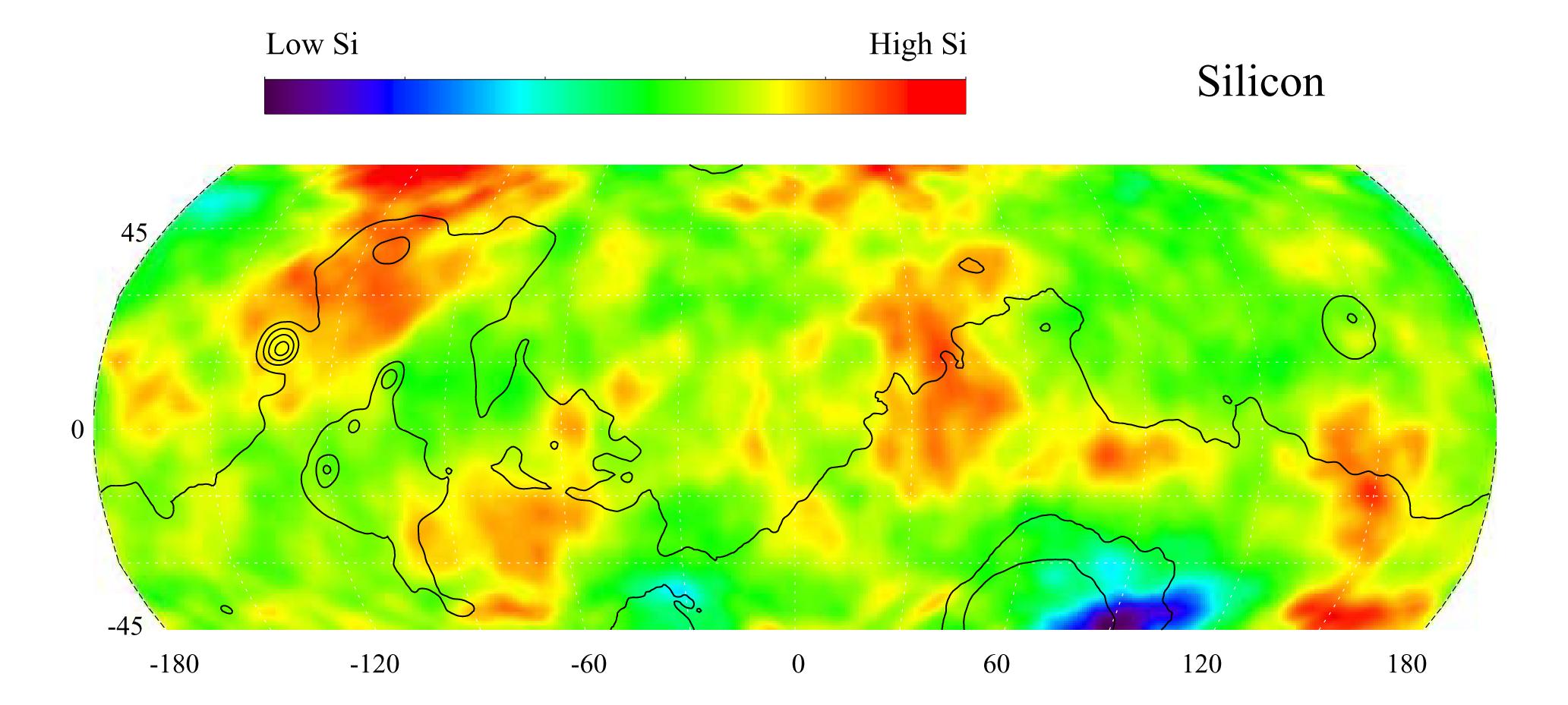
English: This gamma ray spectrometer map of the mid-latitude region of Mars is based on gamma-rays from the element silicon. Silicon is one of the most abundant elements on the surface of both Mars and Earth (second only to oxygen). The most extensive region of highest silicon content, shown in red, is located in the high latitudes north of Tharsis (centered near 45 degrees latitude, -120 degrees longitude). The area of lowest silicon content, shown in blue, lies just to the east of the Hellas Basin (-45 degrees latitude, 90 degrees longitude). Contours of constant surface elevation are also shown. The long continuous contour line running from east to west marks the approximate separation of the younger lowlands in the north from the older highlands in the south.
NASA's Jet Propulsion Laboratory manages the 2001 Mars Odyssey mission for NASA's Office of Space Science, Washington, D.C. The gamma ray spectrometer was provided by the University of Arizona, Tucson. Lockheed Martin Astronautics, Denver, Colo., is the prime contractor for the project, and developed and built the orbiter. Mission operations are conducted jointly from Lockheed Martin and from JPL, a division of the California Institute of Technology in Pasadena. |
| 日期 | (published) |
| 來源 | Catalog page · Full-res (JPEG · TIFF) |
| 作者 | NASA/JPL/University of Arizona |
| 其他版本 |
|

| 此標籤不表示文件的著作權狀態。任何文件在附有此標籤的同時還需要一個有效的著作權標籤。請參閱許可協議說明頁面以了解更多資訊。 其他語言:
|
| This media is a product of the 2001 Mars Odyssey mission Credit and attribution belongs to the Gamma Ray Spectrometer (GRS) team, NASA/JPL/University of Arizona |
授權條款
| 本作品由NASA創作,屬於公有領域。根據NASA的版權政策:“NASA的創作除非另有聲明否則不受版權保護。”(參見:Template:PD-USGov/zh,NASA版權政策或JPL圖像使用政策) | ||
 |
警告:
|
原始上傳日誌
The original description page was here. All following user names refer to en.wikipedia.
- 2010-09-15 03:17 Schaffman 2065×929× (173637 bytes) {{Information |Description = Silicon Map of Mars |Source = JPL Photojournal http://photojournal.jpl.nasa.gov/catalog/PIA04256 |Date = ~~~~~ |Author = University of Arizona |Permission = JPL Public Use Policy |other_v
檔案歷史
點選日期/時間以檢視該時間的檔案版本。
| 日期/時間 | 縮圖 | 尺寸 | 用戶 | 備註 | |
|---|---|---|---|---|---|
| 目前 | 2011年9月21日 (三) 19:49 | | 2,065 × 929(170 KB) | File Upload Bot (Magnus Manske) | {{BotMoveToCommons|en.wikipedia|year={{subst:CURRENTYEAR}}|month={{subst:CURRENTMONTHNAME}}|day={{subst:CURRENTDAY}}}} {{Information |Description={{en|Silicon Map of Mars}} |Source=Transferred from [http://en.wikipedia.org en.wikipedia]; transferred to C |
檔案用途
下列頁面有用到此檔案:
全域檔案使用狀況
以下其他 wiki 使用了這個檔案:
- ca.wikipedia.org 的使用狀況
- en.wikipedia.org 的使用狀況
- en.wikiversity.org 的使用狀況
- es.wikipedia.org 的使用狀況
- no.wikipedia.org 的使用狀況
- sv.wikipedia.org 的使用狀況
- uk.wikipedia.org 的使用狀況